Guadalupe Mountains National Park - United States
Discover the RVezy RV rental marketplace
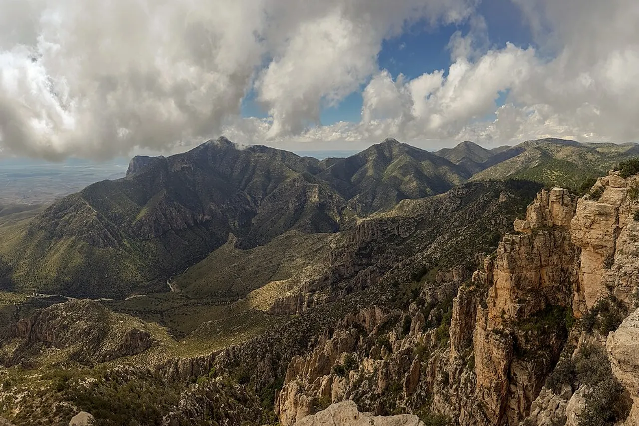
About Guadalupe Mountains National Park
RV quick facts for Guadalupe Mountains National Park
Featured RV rentals for Guadalupe Mountains National Park



Best time to visit Guadalupe Mountains National Park
Spring and fall are the most comfortable seasons for RV trips, with mild daytime temperatures ideal for hiking the park's high-elevation trails. In the fall and spring the park can fill to capacity, so reservations and early arrivals are important. Summer brings hot desert conditions at lower elevations and afternoon thunderstorms, while winter can deliver freezing nights, high winds, and occasional snow on the peaks. Late October and early November are prized for McKittrick Canyon's fall colors.
Cold nights with possible snow and high winds; campgrounds open year-round.
Windy season begins; pack for freezing nights.
Very windy with gusts that can affect high-profile RVs.
Pleasant hiking weather; strong winds common.
Warming quickly; thunderstorms possible.
Hot at low elevations; start hikes early.
Monsoon season; afternoon thunderstorms and flash flood risk.
Monsoon storms continue; watch for lightning on exposed ridges.
Cooler evenings; good shoulder season.
Peak season for McKittrick Canyon fall colors; book early.
Cool days, cold nights; fall color lingers early in the month.
Cold with chance of snow and ice at elevation.
Things to do at Guadalupe Mountains National Park
- Guadalupe Peak Trail StrenuousRV parking available
Guadalupe Peak Trail is a strenuous hike to the 8,751-foot summit, the highest point in Texas. From the Pine Springs trailhead, hikers can travel to the summit of Guadalupe Peak and explore various destinations in the Wilderness. Expect roughly 8.4 miles round trip with significant elevation gain and exposed, windy ridges. nps.gov/places/gumo_pinesprings_trailhead.htm
- McKittrick Canyon EasyRV parking available
McKittrick Canyon is the park's famed fall-color canyon, with bigtooth maples turning red and orange in late October and early November. Easy to moderate day hikes lead to Pratt Cabin and the Grotto. The McKittrick Canyon day-use gate closes in the evening, so plan return times carefully. nps.gov/gumo/planyourvisit/mckittrick_canyon.htm
- Pine Springs Visitor Center and Pinery Trail EasyRV parking available
The Pine Springs Visitor Center is the main orientation stop with exhibits, maps, and ranger information. The adjacent paved Pinery Trail is a short, accessible walk to the ruins of a Butterfield Stage station. Except for the Pinery Trail near the visitor center, most of the trails starting here are rated strenuous with significant elevation gains. nps.gov/gumo/planyourvisit/visitorcenters.htm
- Devil's Hall Trail ModerateRV parking available
Devil's Hall Trail is a moderate hike through a rocky wash to a natural rock hallway framed by towering limestone walls. The roughly 3.8-mile round trip starts from the Pine Springs trailhead and involves boulder scrambling. Footing is uneven, so sturdy shoes are recommended. nps.gov/gumo/planyourvisit/hiking.htm
- Salt Basin Dunes Moderate
Salt Basin Dunes offers a remote day-use area with gypsum dunes on the west side of the park. Access is via a long gravel road, best suited to smaller RVs or towing vehicles. There is no water or services at the trailhead, so come prepared. nps.gov/gumo/planyourvisit/salt_basin_dunes.htm
- Dog Canyon EasyRV parking available
Dog Canyon is a quiet, high-elevation district on the park's north side reached via New Mexico State Road 137. The Dog Canyon District is a two-hour drive from the main Pine Springs entrance and offers a small campground, ranger station, and trailheads into the high country. Expect cooler temperatures and fewer crowds. nps.gov/gumo/planyourvisit/directions.htm
- Stargazing EasyRV parking available
Guadalupe Mountains offers some of the darkest night skies in Texas, thanks to minimal light pollution. The Pine Springs Campground and pullouts along Highway 62/180 are popular for astrophotography and Milky Way viewing. Bring layers, as desert nights can be cold even in summer. nps.gov/gumo/planyourvisit/stargazing.htm
- Frijole Ranch History Museum EasyRV parking available
Frijole Ranch is a restored 19th-century ranch house that now serves as a cultural history museum. A short, easy trail connects Frijole Ranch to Manzanita Spring, one of the few year-round water sources in the park. The parking area accommodates smaller RVs. nps.gov/gumo/planyourvisit/frijole_ranch.htm

RV delivery to 20 campgrounds
Skip the pickup. Skip the towing. Get an RV delivered and set up at your campsite so you can arrive, unpack, and start your trip stress-free.
Choose your perfect RV
Browse RVs that offer delivery to your site and book the one that fits your budget and adventure style.
Lock in your campsite
Reserve your campsite with the hookups and amenities you need. We’ll help you find RVs that meet site requirements.
Arrive and relax
Your host delivers and sets up the RV before you get there. Just show up and start enjoying your trip.
Find the perfect RV for these nearby campgrounds
RV Rentals Guadalupe Mountains National Park
Guadalupe Mountains National Park, TX, United States
How to get to Guadalupe Mountains National Park
The park is 110 miles east of El Paso, Texas, 56 miles southwest of Carlsbad, New Mexico, and 62 miles north of Van Horn on Hwy 54. Every visitor travels U.S. Highway 62/180, which connects El Paso, Texas to Carlsbad, New Mexico and provides views of the park from the north, south, and west. The nearest major airport for fly-and-rent trips is El Paso International, roughly a two-hour drive. RV drivers should plan fuel stops carefully as services are sparse between Van Horn, Salt Flat, and White's City, and should be prepared for strong crosswinds, long climbs toward the Guadalupe Pass, and limited cell coverage.
RVezy vs. Traditional RV rental
RVezy rentals
- Book directly from local RV owners
- Choose the exact RV you want
- Delivery to your campsite, home, or destination
- More variety: trailers, motorhomes, and campers
Traditional RV rental
- Limited fleet from a rental company
- Exact RV not guaranteed
- Pickup only at retail locations
- Fewer RV types and less availability